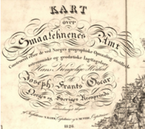
 Continuing my series on maps, here is a beautiful historic map that covers all of Norway and clearly shows farm locations. Provided by Statens Kartverk, this map is actually a searchable composite map created by stitching together multiple historic “Amtskartene” (county maps) drawn between 1826-1916. Each county had up to 4 separate maps; here, the map has been rectified so it joins together and overlays perfectly on a contemporary map. Use the tools in the map window below to view other areas, or to view the map in a larger window go to norgeskart.no and choose “Historical Map Series” then “Historisk Amtskart” in the menu on the left.
The table under the map can help you determine the specific date for each region. DIS-Norge (a Norwegian genealogy association) allows paying members to download an individual county map from this series. Google Earth users can download GeoNorge’s geo-referenced KML file for the full pan, tilt and fly-through historic experience (but the GeoNorge server seems a bit sluggish).
[htmlembed name=”Amtskart”]
Original map information
| County (amt) | Sheets | Scale | Year |
|---|---|---|---|
| Østfold (Smaalenene) | 1 | 1:200.000 | 1826 |
| Akershus | 1 | 1:200.000 | 1827 |
| Hedmark | 3 | 1:200.000 | 1829 |
| Vestfold (Jarlsberg-Laurvig amt) | 1 | 1:200.000 | 1832 |
| Oppland (Kristians amt) | 3 | 1:200.000 | 1845-51 |
| Buskerud | 2 | 1:200.000 | 1854 & 1856 |
| Telemark (Bratsberg) | 2 | 1:200.000 | 1852 & 1857 |
| Austagder (Nedenes) | 2 | 1:200.000 | 1858-59 |
| Vestagder (Lister og Mandal) | 1 | 1:200.000 | 1862 |
| Rogaland (Stavanger) | 2 | 1:200.000 | 1860 |
| Hordaland (søndre Bergenshus) | 2 | 1:200.000 | 1867 |
| Sogn og Fj. (n. Bergenshus) | 4 | 1:200.000 | 1874-80 |
| Møre og Romsd. (Romsdals) | 4 | 1:200.000 | 1882-85 |
| s. Trøndelag (s.Trondhjem) | 3 | 1:200.000 | 1901-04 |
| n. Trøndelag (n.Trondhjem) | 3 | 1:200.000 | 1908, 1913, 1917 |
| Nordland | 2 | 1:600.000 | 1916 |
| Troms (Tromsø) | 4 | 1:200.000 | 1874 |
| Finnmark | 2 | 1:400.000 | 1870 |


2 Responses to Historic Norwegian “Amtskart” Maps