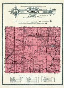
 Plat maps are an excellent resource for local history research. They show where a family lived and farmed, can demonstrate migration over time, and provide context when digging through census records. They can also be used to identify the locations cited in land grant, homestead, and probate records. High-resolution plat maps are clear and easy to read, though some of the links below are watermarked – just scroll the image to get around it.
I’ve included the earliest maps up to 1950 – though maps up to the 2000s are available from Historic Map Works – and have linked to the cleanest images available. If you know of any others – please leave a comment below and share with everyone.
Allamakee County, Iowa
1875 A.T. Andreas Illustrated Map
1886 Warner & Foote Allamakee County Plat Map (Iowa Digital Library)
1917 Waukon Standard Allamakee County Plat Map (Historic Map Works)
1917 Anderson Publishing Company Allamakee County Plat Map (Library of Congress)
1950 Waukon Newspapers Allamakee County Plat Map (Historic Map Works)
Family Maps of Allamakee County (book) shows original land patent records, most dating from the 1850s
Winneshiek County, Iowa
1875 A. T. Andreas Illustrated Map
1886 Warner & Foote Winneshiek County Plat Map (Iowa Digital Library)
1905 Anderson Publishing Company Winneshiek County Plat Map (Historic Map Works)
1915 Webb Publishing Winneshiek County Plat Map (Historic Map Works)
1930 W. W. Hixson & Co. Winneshiek County Plat Map (Iowa Digital Library)
1940 Decorah Public Opinion Winneshiek County Plat Map (Historic Map Works)
1944 Decorah Public Opinion Winneshiek County Plat Map (Historic Map Works)
1948 Joe C Johnson Winneshiek County Plat Map (Historic Map Works)
Family Maps of Winneshiek County (book) shows original land patent records, most dating from the 1850s
Houston County, Minnesota
1874 A. T. Andreas Illustrated Map
1878 Warner & Foote Houston County Plat Map (Historic Map Works)
1896 Geo. A. Ogle Co. Houston County Plat Map (Historic Map Works)
1931 Webb Publishing Company Houston County Plat Map (Historic Map Works)
Family Maps of Houston County (book) shows original land patent records, most dating from the 1850s

